Please note you will need to have Google Earth installed on your PC in order to open the above file, and I highly recommend having Google Earth just for itself because it truly is a most incredible piece of software.
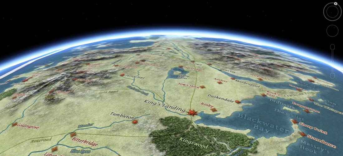
Before I started work on the animated timeline map project using Flash I was exploring the possibility of using Google Earth to do the same thing. I created a map that replaces the standard Earth map with a blank blue map onto which I placed the map of Westeros created by Tear and I also added the map of Slavers' Bay in roughly the location where it would be in relation to Westeros. Sadly I have no skills or knowledge in using KML (the language that Google Earth is programmed with) and so I determined that it was going to be better to use Flash which I have a better understanding of.
But I still think this map of Westeros in Google Earth is useful since you get a real sense of the scale and zooming low over the curvature of Westeros is pretty cool.
See below for further details about Version 2.0 which includes my Speculative World Map.
UPDATE: This new version uses my Speculative World Map as the base and includes separate image layers for map features which can be turned on and off. Beware that this is extremely memory intensive and in fact I have not been able to get the label layers to display fully on my PC. Google Earth instead switches off the other layers automatically dropping the labels onto the default earth map which looks very strange. Those of you with newer faster better computers will hopefully not suffer this problem, but for those in the same position as me I have the label layers switched off by default.
If your PC simply cannot cope with version 2.0 then you can always try the older versions which use Tear's map of Westeros and the maps from the books, coupled with the HBO map of Essos in version 1.1.
Please note that the position of the map in relation to its North/South axis is off because in order to avoid stretching the image too much at the poles I needed to align it with the centre of the globe. I left the borders around the edge to show that this is a closed map at the moment.